GREAT LAKE STUDIO
Location:
Dates:
Crew:
Duration:
Start:
Finish:
Wabakimi Provincial Park
August 04-18, 2024
Mom & Dad, Levi, Ozzie (dog)
15 days
Change Lake
Bukemiga Lake (Kopka River)
Location:
Dates:
Crew:
Duration:
Start:
Finish:
Wabakimi Provincial Park
August 03-17, 2025
Mom & Dad, Levi, Ozzie (dog)
15 days
Burntrock Lake
Bukemiga Lake (Kopka River)

This page chronicles a 15-day canoe trip through Wabakimi Provincial Park in August 2025. For detailed route info, refer to the interactive map above.
We visited Wabakimi for the first time last August, and before that trip had even ended we knew we’d be back again next year. Many dark winter nights were spent researching that first trip, scouring maps and every online resource I could find. And while there are nearly endless possible canoe route options, there were three separate trips, each of roughly two weeks duration and traversing a completely different area of the park, that stood out to me as especially intriguing. This year, we were back to paddle the second of those three routes.
Our plan was to fly into Burntrock Lake in the north-east corner of the park and paddle the Palisade & Greyson river systems into Whitewater Lake. From Whitewater, we would travel up the Ogoki & Berg Rivers into Outlet Bay and Smoothrock Lake, before continuing upstream on the Boiling Sand River to Tamarack Lake. The final leg of the journey promised to be its own special adventure: we would attempt a series of unmaintained and seldom used portages into Rushbay Lake and then down the Collins River to Bukamiga Lake and our exit point on the Kopka River. As with last year's trip, this route would connect many interesting sections of the park, with a wide variety of lake and river travel, wetlands, canyons, rapids, falls, and who knows what else - there was so much to be excited about!
But it almost didn’t happen. 2025 was the second worst wildfire season in Canadian history, with northern Manitoba and Saskatchewan at the epicenter. In the weeks leading up to our departure, we kept a nervous eye on satellite imagery of the enormous, metastasizing blob of smoke wafting eastward over northwestern Ontario. Sometimes it would bend far to the north, or south toward the US border, but much of the time it appeared firmly anchored directly over Wabakimi. After much debate over whether we should visit a different part of the province instead, we decided to take our chances and go for it, packing N-95 masks as a precaution... just in case.


August 2
Arrival at Armstrong Station
Sunny, 25°
The 17-hour drive from Toronto to Armstrong Station just south of the park is murderously long, made tolerable thanks to the portion from Sault Ste. Marie to Thunder Bay, which is truly spectacular, and without question the most scenic drive in Ontario. Climbing up and down the mountainous (yes, mountainous), rugged shore of Lake Superior, you may forget that you are still in Ontario at all. We've only been this way a few times in recent years, and for the second year in a row the drive up and over Superior would be a fresh and exciting highlight. For the first part of the drive we enjoyed mostly clear skies, but as we left the town of Marathon at sunrise for the final stretch, a light brown haze began to settle in, slowly thickening as we crept further westward and then north, past Lake Nipigon, to the end of the road at Armstrong Station.
Armstrong was already familiar to us and hadn’t changed in the slightest since the year before. Its foremost defining feature is the expansive railway yard running the length of town, which also presents the best opportunity you’re going to get for a little fun poking around. We stretched our legs walking the tracks and clambered around on a few of the many small single-seat maintenance cars strewn about, before accidentally stumbling upon Wabakimi Provincial Park’s only lonely presence here: a modest, un-staffed information kiosk with a large park map and picnic table. We missed this entirely last year, and nearly missed it again!
Having explored Armstrong's modest diversions, we retired to our lovely log cabin on Mattice Lake, just south of town. Once again, we were staying with Don & Kim at Mattice Lake Outfitters (highly recommended), who also organized our flight and car shuttle. We would be flying out to Burntrock Lake at 7am tomorrow morning.
From the porch of our cabin, we watch the sun hang low over Mattice Lake, dimly red and ominous in a smoldering charcoal sky. If there is any upside at all to the forest fire smoke, it would be the otherworldly atmosphere it creates at sunset. We could just as well be gazing across the surface of Mars. Not what we had in mind to be sure, but undeniably beautiful nonetheless. Besides, the smoke really hasn’t been such a bother. Perhaps all that worry was for nothing.


August 3 - Day 01
Armstrong Station to Burntrock Lake (by float plane)
Smoke, 24°
The morning brings much to be worried about! Hauling our gear to the dock where the plane awaits, the smoke is so thick I can taste it. The sun has vanished, smothered beneath a deep sepia haze. That drifting brown smudge we’d been tracking from space is no longer just an abstraction but real and suffocating, seeping into our eyes and lungs.
The situation is even more oppressive in the air. The pilot has every window fully open – not for the fresh air, I assume, as there is no fresh air to be had. My eyes and throat are burning, as if the sky itself were on fire. As the plane rattles onward toward the far corner of the park, a quiet anxiety begins to take root. It's unclear what, exactly, we may be flying into - or how much worse it might possibly get. One thing is certain: it would be hard to imagine spending a full two weeks in conditions like these.


The plane banks sharply left and we glide into the south-eastern arm of Burntrock Lake, not far from where it drains into the Palisade River. Normally we would set-up camp right here and ease into our new surroundings slowly, but today we are all business. We have an ambitious route planned and will take days off further along as we need them, to rest, or adjust to weather, or any other impediments. Our goal for today is to follow the river downstream to an area known as 'big bend', with four marked portages to get through. A quick middle-of-the-lake loading of our gear into the canoe, and we're off!
The Palisade is lovely from the get-go - winding and intimate, at times constricting into fast moving swifts with just enough depth and volume to navigate with ease. At the second marked 63-metre portage, we glide cleanly through a long set of swifts with barely a ripple, lightly brushing low boughs of encroaching cedars. The scenery is quite pretty and constantly changing - even the portages are scenic, skirting around one small set of falls after another.

The intimacy of the landscape is especially welcome given the circumstances. Up close, the landscape is vivid - textured Canadian Shield, brightly sparkling water, the richly saturated colors of the boreal forest... But each time the river occasionally widens and we are more than a hundred meters or so from shore, the world dissolves colorless and featureless, behind a veil of smoke.
We also happen to be paddling through an old burn area, still early in its recovery. Young pines crowd the shoreline, rising up from charred remains that sweep across the land in every direction. The scale of destruction is unsettling - yet another bleak reminder of the environmental catastrophe unfolding to our west. It all makes for a rather subdued beginning to the adventure.
After the fourth and final portage, we slip through a narrow channel with a flat ledge of exposed shield to one side, and are startled by a squadron of ducks exploding off the shoreline. We assume it is us who have startled them, before rounding the bend a bit further where a lynx appears at the water’s edge. Lanky and poised, with its distinctive black tipped ears, it examines us for a few moments with no apparent concern whatsoever, then calmly and silently disappears into the forest. We have never seen a lynx in the wild - they are famously elusive creatures - and the encounter lingers with us long after it is gone.
We call it a day at a campsite that a few trip reports I'd come across had described as “world-class”. This is generous praise, and we wonder how such opinions proliferate. It's a bit lumpy, and a bit marshy, with a few withering black spruce scattered about - perfectly adequate, but definitely nothing special. Still, it’s home for the night, and we are glad to finally have a chance to take pause and enjoy some peaceful stillness. Levi wants to take the canoe out to fish, and quickly nets three good sized walleye as we troll back and forth just offshore. I had forgotten just how effortless it is to catch fish in Wabakimi. The lakes are literally teeming with fish.
A light sprinkle drifts in after dinner, cooling the air nicely. We build a small fire and sit with it until dusk settles, before the exhaustion of a long first day overtakes us all.


August 4 - Day 02
Palisade River
Cloudy, 20°
We sleep late, feeling quite refreshed, enjoying coffee in a perfect silence interrupted only occasionally by the soft 'bloop' of jumping fish. Weather is overcast and cool, but there is far less smoke hanging in the air, and that alone is great news. Setting off, we quickly arrive at another campsite right across the bay where the first portage begins, and it is so much nicer than where we stayed last night: elevated on a high, rocky point with a great view and a flat, sheltered tent spot. Just to the side, the river cascades over a lovely little falls.
On the other side of the portage the riverscape begins to change, enclosed within vertical walls of granite that become more dramatic the further along we go. We stop for lunch at a 100-meter portage surrounded by majestic cliffs and jagged, house-sized fragments that have calved off the rock face and now stand in the water like colossal sentinels. Not far beyond is a spectacularly situated campsite occupying a point with the same soaring cliffs immediately behind. It’s a little early to make camp, but we’ve given ourselves 5 days to get to Whitewater Lake and staying here would not put us behind schedule. We jump out to investigate. It appears no one has camped here in a very long time - there is an old fire ring, filled-in with moss and tall grasses. The only drawback is that the tent spot (if there ever really was one) is very small, lumpy, and overgrown. But this place is so lovely in every other way, we decide to make it our home for the night. I cut a bundle of cedar boughs from back in the woods and do my best to level out a reasonably comfortable bed for our tent.


Wabakimi does not have designated campsites. While established and obviously well-used sites do exist, they are few and far between, sometimes leaving you fending for yourself to improvise a suitable bush site. Unfortunately, camping prospects in Wabakimi are often less than ideal, even at the established sites. This is not because there aren’t thousands of gorgeous places I’d love to stop and spend an evening (there most definitely are), but because the landscape is so broken and wild, finding a level patch of ground big enough for a tent is often a real challenge. Sleeping hammocks have become a popular alternative to tenting in recent years, and they have some real advantages in a wilderness as rough as this, especially for solo trippers. A pair of sturdy, adequately spaced trees is all you need to make just about any cozy spot you might like to hang out in a comfortable place to sleep as well. The narrow point of rock we are occupying tonight is a perfect case in point. We've given hammocks serious consideration, but as a family of three, we've decided that a tent probably suits our needs better overall, and continue to take our lumps with tenting.

Levi and I swim for a while, then take the canoe back out so he can fish.
Maggie and I don't fish and we have mixed feelings about Levi fishing for fun. There is a mortality rate associated with catch-and-release fishing. The number varies depending on your source, but the point is the same: some of the fish you catch are going to die, from injury, or stress, or both. Obviously, you can look beyond this fact if you are consuming the fish you catch, but we are not doing that. The very last thing we want to do out here is injure animals. So why are we fishing at all?
Almost immediately, the line goes taut and the rod doubles over. Levi has hooked something… something very big… a pike – easily the biggest fish he’s ever caught, more than two feet long. He needs my help with the net but otherwise handles it entirely himself. Pulling a fish that size out of the lake on his own is both a thrilling adrenaline rush, and, I imagine, a profoundly fascinating experience for him. Pike are not like other fish. They have an almost prehistoric appearance, with reptilian patterning, bulging black eyes, and frightening rows of very sharp teeth. Levi’s face is completely lit up in awe of the monster suddenly in his lap. He certainly doesn't want to hurt it, and hadn't even considered that as a possibility, before now.
Holding the fish steady to extract the lure, I discover it has been swallowed completely. We have long-nose pliers for extracting hooks, but the crankbait - a lure fitted with barbed treble hooks – is so deep inside the fish’s gut it can barely be reached. Working at it only seems to make things worse, and after a few futile minutes I share the unhappy reality of the situation: we are never going to get the lure out.
I had no idea how best to handle this. We talked about cutting the line and just letting it go, but it seemed to me this would only ensure a slow and painful death. I couldn't imagine it surviving, or even swallowing food, due to the obstruction. We sat silently thinking for a few moments. Then, quietly tearing up, Levi suggested that perhaps we should kill it. It startled me that he understood before I did what needed to be done. We drifted over to shore. I laid the fish on the rocks and told him not to look. Three hard strikes with the edge of my paddle and it was over, but the weight of it landed on both of us heavily.
After returning home weeks later, I read conflicting opinions about the most humane thing to do in a situation like this. Several accounts suggested that leaving the lure in the fish's gut isn't necessarily a death sentence, and that it would dissolve in time (I'm no expert, but I found this hard to believe). To those with more experience who may be reading this account, please don't judge us too harshly...


August 5 - Day 03
Palisade River to Scrag Lake
Sunny, 25°
Between the stump rising out of the ground under me and the huge root rising out of the ground under Maggie, neither of us slept particularly well. Levi (always in the middle and always gifted the choicest patch of ground) snoozes peacefully as we stretch out aching backs and slowly move through the morning routine of boiling water for coffee and oatmeal. Dense fog blankets the slow-moving river, profoundly still and quiet. We chat over breakfast in hushed tones, not wanting to disturb the beautiful silence. The tranquility continues as we launch quietly downstream, the only sound being the soothing, repetitive dipping of paddles. Every canoe tripper lives for mornings like these.


Scenery along the Palisade continues to be quite dramatic, twisting and turning through a series of narrow channels. At several spots along the way, long forks branch off from the main channel, each one a tantalizing invitation to explore. Our topographical map of the area is covered with dense bundles of contour lines, signaling impressive cliffs everywhere. We could happily spend two weeks just exploring the complex network of deep bays and small, secret lakes scattered throughout this fascinating corner of the park. But for now, all shall remain roads not taken.
The fog lifts, and for the first time we enjoy smokeless blue skies and full sun. We pause for lunch at a natural rock bench along the south shore of Slim Lake, then continue west through a very narrow channel barely wider than our canoe. A series of two short portages climb steeply up over high bald hills before descending steeply back to the water. Both are quite scenic, offering panoramic views back the way we have come, and distant glimpses of the way ahead. The second portage is especially steep, and we are running out of steam as we arrive on Scragg Lake under a blazing afternoon sun.


Despite it’s unappealing name, Scragg Lake has very big appeal, featuring an interesting shoreline with plenty of smooth exposed rock. At this point we are on the hunt for a campsite, and scope out many different areas of the lake without luck. Once again, there are dozens of incredible places to swim and hang out, but none reasonably level enough to sleep in a tent without thoughts of a middle-of-the-night slide down the rock face and into the water.
There are no established campsites indicated anywhere on Scragg. After searching for the better part of an hour we are beginning to worry, as the next lake over (Arril Lake) is a long paddle away, with at least four marked portages to get through. As the sun descends, weakened from fatigue, we press on toward a bay at the very north end of the lake where I have scribbled, ‘campsite??’ with an arrow pointed vaguely toward that area. There is indeed an unmarked campsite there - the best one of the trip thus far - spacious and open, with a great hang-out area, great view, and (best of all) an impeccable tent site so level, free of roots and stumps, and delightfully spongey atop a bed of thick mosses that I practically CANNOT WAIT to stretch out in a horizontal position and drift off into a heavenly slumber. The only downside is that the water here is a bit mucky for swimming. We don't mention to Levi the many leeches being stirred up while he splashes around happily in the water. I think we're all too tired to care.

August 6 - Day 04
Scrag Lake to Arril Lake
Cloudy, 22°
We awake to a beautiful red sun hanging over the north end of Scragg Lake, exactly where it empties into the headwaters of the Greyson River. This is where today’s adventure begins, with three portages of 250 meters, 430 meters, and 70 meters, all in quick succession.
The Grayson begins as little more than a faint trickle through a boulder garden, with no apparent portage anywhere in sight. We wade through tall grasses along the slightly raised riverbank, finding that to be easier than hopscotching over rocks. The next portage (430 meters) seems quite a bit shorter than it ought to be, and we’re feeling great about having gotten the two big portages of the day behind us so quickly. The next 70-meter carry is supposed to be on river right, but we see an obvious takeout on river left instead, and naively muse (with a chuckle) that the FOW map could probably use a bit of an update. The trail is well established, but it goes on and on, then up and up, and a good distance further along a high forested ridge. It’s a slow-going obstacle course with deadfall everywhere, which is odd given how clear the other portages have been. None of this is making much sense, but we eventually reach the open river again, which is all that really matters. This sort of confusion is common in Wabakimi, where portages are unmarked and often poorly defined.


More boulder gardens but eventually the river deepens, presenting an opportunity to paddle our canoe rather than carry it, which is always welcome. We stop for lunch at a riverside ledge and discover the remnants of a very old fire ring tucked back out of sight. Covered in moss, with a mature tree rising out of it, I wonder who the last person to use it might have been, and when. 50 years ago? 100 years ago? Most of the established routes through Wabakimi are ancient, travelled by Anishinaabe people for thousands of years. Long before European contact, the Anishinaabe would have padded these very same waterways and walked these very same trails. Would they have looked exactly as they do today? Would they have camped in the same places that we have? Would they have bitched about the tent sites in the same way that we do? Who can say? It’s fascinating to contemplate…


Dark clouds rip across the sky as the river bends into Arril Lake. The wind has picked up, pushing at our backs as we cruise across the wide expanse of open water on rolling black swells. Our destination for the day is a marked island campsite just beyond where the lake pinches into a narrows, and it appears we are just in time, with a gathering storm moving in behind us.
Once through the narrows, winds are gusting stronger, bringing intermittent sheets of rain. Rounding toward the backside of the island, we are very much relieved to be getting off the water as the campsite finally comes into view. To our dismay, the place is an absolute mess. It is rare in our experience to come across a patch of remote wilderness so thoroughly abused and unloved. Scattered across an open granite slope are ugly heaps of charcoal, blackened rocks, and partially burned stumps where previous visitors have lit large, uncontained fires. Several mature trees near the water have been hacked down leaving waist-high amputated stumps, presumably by someone too lazy to march back into the forest for firewood. ‘Leave it as you found it’ is the sacred covenant of backcountry camping, and we cannot fathom why anyone who wanted to come here in the first place would be so thoroughly disrespectful.
On the way in, we noticed another, much smaller rock slope poking out from the opposite side of the very same island. It would be far too dispiriting to spend the night here, so we jump back into the boat and paddle around for a look. The little slope is quite charming. There is deadfall all over the place, which would take some time to clear, but back in the woods there is a reasonably decent tent site covered in soft, spongy moss. With some effort, we could turn this into a pretty comfortable home for the night.
Long distance hikers sometimes speak of a mystical phenomenon known as ‘Trail Magic’, but it is applicable to canoe trippers all the same. It refers to serendipitous moments of inspiration or good fortune, usually arriving unexpectedly and just when you need them most. Trail Magic is usually quite a small thing on its own, but it has the power to turn a bad situation into a very good one - that’s what makes it magical.
We put the tarp up and Levi writes in his journal while we scurry about in heavy rain, making camp and preparing dinner with military efficiency. Suddenly, and unexpectedly, the rain ends and the lake goes still and quiet. The deadfall I've cleared is cut and stacked, and we build a warm, welcoming fire out on the point. At the very moment our work is complete and we are finally able to sit and rest, the sky clears and heavenly beams of sunlight shine down upon our modest, improvised camp. The rain and wind are behind us and forgotten, as is the vandalized ash heap on the far side of the island. We laugh at our luck in finding this place, as a double rainbow fills the sky overhead. In that particular moment, there was truly nowhere I would rather have been.
Pure Trail Magic.

August 7 - Day 05
Arril Lake to Whitewater Lake
Sunny, 26°
The sun rises just above the tree line and immediately disappears behind a low blanket of cloud cover, its ragged edges briefly set ablaze with tips of pink and gold. Wisps of morning fog blow across Arril Lake as we bid farewell to our happy impromptu campsite, heading for the first portage of the day – a straightforward carry of 295 meters. Very rocky at the put-in, but soon we are flying along through fast moving swifts – an invigorating start to the morning.
The sun fights its way back out as we enter the east arm of Grayson Lake – the biggest lake of the trip so far. Levi reclines in the middle of the boat, his feet up and fingertips dragging leisurely through the water as we fly along with a stiff tailwind from the south. We enter the main body of Grayson, with long views down diverging north and south arms. There are two ways to proceed from here. Option A: turn south, battling exhausting headwinds and chop all the way to the end of the channel, then continue along the Grayson river through a series of four short portages. Option B: cross into a sheltered and friendly looking bay directly ahead and take a single long portage of 750 meters – a significant shortcut that would put us in a very good position to reach Whitewater Lake earlier in the day. There has been no shortage of river travel on this first leg of the journey, so we don't feel we'd be missing anything in taking the shortcut. Besides, we are feeling a bit fatigued. A short portage takes nearly the same time and effort as a longer one – it’s the loading and unloading of everything in and our of the water that is most time consuming and strenuous.
The shortcut seems like a no-brainer, but first, lunch. There is a cluster of islands a short paddle out across open water, the closest with a wide ledge at the base of a cliff – the perfect spot to pause for a break. Levi and I follow the edge of the cliff up to the top and discover a little plateau with a fire ring. The view from here, overlooking the entirety of Greyson Lake, is spectacular (if only there were a feasible tent site). The wind has intensified, ripping up the south arm, which makes heading off in that direction even more unappealing. After lunch the vote is unanimous: shortcut, here we come!

We head into the bay and after a bit of searching, locate the portage which obviously isn’t used much. It has a terrible takeout, requiring us to awkwardly lift our canoe and gear out of the water over several large boulders. At 750 meters, this will be the longest portage of the trip thus far. Our topographic map indicates mostly high terrain, so we imagine this will be a relatively dry trail. It is not.
The trail takes the form of a muddy trench, about a foot wide and two feet deep, hemmed in tightly on both sides with dense, prickly scrub. There are two ways to walk this: plod through the narrow mucky trench with one foot placed directly in front of the other, or take a side-to-side ‘hop-step’ approach, keeping the trench between your feet. Neither of these is much fun, especially with a canoe on your shoulders. I made the mistake of wearing shorts and take a particularly harsh lashing of bare legs while attempting the 'hop-step' method. Switching to plodding through the mud, I immediately loose a shoe. Despite it continuing on this way for quite some time, Levi is in relatively good spirits, which is all that really matters.
Eventually we reach the elevated section our map had promised and begin climbing upward, into a different set of challenges. There is deadfall scattered everywhere across the hillside, like an overturned box of matchsticks, providing endless waist-high obstacles to muscle over. Additionally, any sign of a trail has all but disappeared. The dry, rocky terrain leaves no trampled ground cover and has no muddy path. We stumble across subtle clues here and there - a cut branch or small rock cairn - but these are few and far between, difficult to spot, and easy to miss. It’s a blazing hot afternoon, very slow going, and equally exhausting. We stop several times, tossing equipment to the ground in frustration, unsure of where we are, or where we are going. After close to an hour, we arrive at a steep and difficult to negotiate step in the rock, carefully hoisting our packs and canoe down the rock face to the bottom, only to find we have reached a dead end.


Controversial parental tip: never admit you're lost, even if you are REALLY lost, and ESPECIALLY not to your children.
I confidently declare that we are at least halfway through this mess, but Levi is no longer buying it. After a rest we manage to rejoin the trail again, but spirits have bottomed out and there is no telling how much farther we still have to go.
Eventually, we begin heading downhill - an encouraging sign at last. Ozzie and I are scouting the trail a good distance ahead, when Levi suddenly begins screaming in agony. The worst thoughts enter my mind as all of us rush to his aid (a twisted ankle? Please not a break!). Maggie, who is taking up the rear, noticed a swarm of insects burst from the ground just as Levi stepped across a rotted tree stump in the middle of the trail – it appears he has disturbed some sort of nest and has been stung multiple times on the legs. This, unfortunately, is a last straw for him. Between the length and difficulty of the trail, his anxiety that we may not know where we are going, and now the wasp attack, he collapses into an inconsolable, profanity-filled meltdown.
Surely, we must be nearing the end of this! I fling down my pack and sprint ahead alone, desperate to find the elusive trailhead. With a mix of jubilation and incredulous disbelief I glimpse water through the trees not too far in the distance - the exact same river we left hours earlier, and only marginally further downstream.
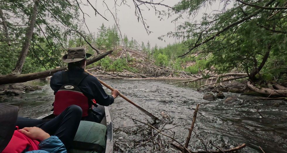
Levi is at his wits end, so we set him up to rest on a little sunny rock while Maggie and I drag the canoe through one last section of knee-deep muck to the edge of open water. We carefully load our gear, Levi, and then Ozzie into the boat before Maggie climbs across and into the bow. I will push us off from the stern with one foot in the canoe and the other on a little tuft of grass - a routine maneuver, except the little tuft of grass just sinks under my weight, resulting in an impromptu sideways full-body plunge into swamp water. This was indeed the Portage from Hell, taking more than two hours to complete. The longer route would have taken more time, but far less of a toll overall.
We launch into the tail end of the Grayson River and soon arrive at Whitewater Lake – our destination for the day. Just offshore sits a lovely island campsite, quiet and peaceful, our home for the night at last.


August 8 - Day 06
rest day at Whitewater Lake
Sunny, 28°
We decide to take a rest day here, which was always the plan anyway, and it feels great to be so ‘on schedule’ for a change. In our minds, this trip divides cleanly into three parts, and arriving at Whitewater Lake marks the end of part one. Everyone is ready for a break and we’re delighted to have a beautiful day and a great campsite where we can spread out and relax.
The day is spent indulging in the simplest of pleasures: We enjoy two pots of coffee (two pots!) over a long, lingering breakfast… We spend hours swinging in hammocks, lost in good books... We wash filthy clothes which dry crisp as boards in the hot sun… All of this would be completely mundane were we back home in Toronto, but brings outsized satisfaction out here, within the context of a long canoe trip.


In the afternoon, we make the short paddle back to where the Grayson River tumbles out of the woods and splash around in gentle rapids, cool and refreshing on a very hot afternoon. Preparing dinner back at camp, we see movement on the shore across the bay: a solitary adult black bear, sauntering along the shore, sniffing and exploring.
Tomorrow, we begin part two of the journey with a long crossing of Whitewater Lake – the widest body of open water in all of Wabakimi. Crossings like this always make me nervous. If there is wind, conditions on the water could be rough and stressful, but we won’t know what we are facing until the morning. Once safely across Whitewater, we will begin making our way upstream on the Ogoki River, which shouldn't present any significant challenges.

The evening unfolds on a long point overlooking the bay. The skies in this part of Ontario are prairie-like in their expansiveness, and the heat summons just about every type of weather and atmospheric phenomena. Towering thunderclouds - luminous white, pink, and indigo - stroll in from the west. Dark sheets of rain mingle with celestial beams of golden sunlight. All of it builds into a spectacular, operatic display as the setting sun punches through, setting the whole scene ablaze. We retire to our tent rested and recharged, excited about what lies ahead.

August 9 - Day 07
Whitewater Lake to Ogoki River
Showers, 24°
Light rain this morning, but not a breath of wind. Whitewater Lake is smooth as glass and we intend to make the most of our good fortune by getting this crossing behind us as quickly as possible. It's an enjoyable paddle in spite of the rain, mainly because we'd braced ourselves for something much more strenuous and stressful.
As the opposite shore emerges through a veil of rain and mist, we see the white froth of a powerful set of rapids where the Ogoki River gallops into Whitewater Lake. Not far down the sandy shore to the left is a little cluster of cabins with green roofs. This is Whitewater Lodge - one of three fishing camps we have passed since leaving Burntrock Lake seven days ago. The other two (on Arril and Greyson Lakes) appeared tightly shut for the season, and Whitewater Lodge looks the same, with no boats or other visible signs of activity. We will be continuing upstream on the Ogoki and are looking for a portage that will take us around the rapids, located somewhere between the river and the lodge.
The current picks up as we cross into the Ogoki River inflow, but it seems completely manageable and we are a good distance away from any turbulent water. We begin a straightforward upstream ferry, with the boat just slightly angled against the current. Because Maggie is in the bow, she has a better view of what is immediately before us, and as we reach the middle of the channel, she would later describe the water flow as accelerating in an instant from “10 to 90”. Everything happened so fast. The last thing I saw was a deep swale in the river to my left behind a gigantic boulder lurking just beneath the surface. None of this was visible from where we began the crossing, or at any point until now.
The fast current grabbed the nose of the boat, wrenched it to the left, and rolled us over. Suddenly we are all in the water, flying downstream, clinging to our overturned canoe in a state of panic and shock. Maggie, Levi, and I are all together, but I can't immediately locate Ozzie until I feel him kick my leg – Ozzie is trapped under the boat. I reach under and pull him out, wide-eyed and trembling. Levi is terrified and inconsolable. The current begins to slow, and I am able to wrap my legs under the stern of the still upside-down boat, paddling us backwards toward shore. We were in the water for about 20 minutes.
Before we started the crossing, I thought it would be interesting to take some video of the approaching rapid (GoPro clamped to the gunnel), and inadvertently captured the whole episode. There is audio, but I can’t bear listening to Levi’s muffled cries for help.

We were lucky. Everyone is ok. We did hit some rocks soon after capsizing, but nothing more serious than skinned knuckles and elbows, which I took the brunt of. Levi is in a state of shock, however - pale with fear and trembling uncontrollably. Getting him warm, dry, and calm is the only thing on our minds.
Whitewater Lodge is not far down the beach. Maggie suggests that we could shelter there if any cabins are unlocked, at least until Levi has settled down - a good plan, and off they go. I stay behind to haul our soaking gear out of the water and get everything secured. At this point, I assume the trip is over. Our canoe is still upside down in the water, and most of our gear is probably strewn across the bottom of the lake.
I manage to roll the boat over and discover, miraculously, that we haven't lost anything. Somehow, all of it remained trapped under the canoe, even a few items that were loose when we capsized (a water bottle, a fishing net, all three of our paddles). This is incredibly good news, but Levi remains a concern. As soon as everything is safely ashore I run down the beach toward the lodge.

Whitewater Lodge appears completely desolate, with Maggie and Levi nowhere to be seen. I run up the beach, calling out, and hear voices coming from a small, rustic guesthouse – Levi’s voice, but unfamiliar ones too, laughing and talking excitedly. Peering through a closed screen door, panting hard and still in an adrenaline-fueled state of panic, I am welcomed enthusiastically by a beaming young couple sitting on a sofa, surrounded by a decor of moose antlers, trophy fish, and faded photos of smiling anglers covering the walls. Levi sits in a plaid upholstered recliner, a cold Pepsi in one hand and half empty bag of potato chips in the other. His legs swing back and forth above the floor in relaxed contentment.
We have been rescued, you might say, by Tyler and Kelsey - the caretakers of the lodge, who live here all summer with their 10-year old son, Cali. Apart from the three of them, the place is completely empty. Maggie has already explained what just happened to us out on the water. They are warmly understanding, relaying the story of a father-and-son party who capsized in the exact same spot just a few weeks earlier. Those two were apparently not as lucky - losing everything, and needing to be flown out.
Tyler & Kelsey very generously invite us to take a cabin for the night, which Levi immediately accepts on our behalf before we have a chance to open our mouths. Truth is, we couldn’t be more grateful. We spread our soaking wet gear out in the sun and slowly dry everything out. Levi and Cali hit it off immediately, neither of them having lately spent much time with another kid their own age. This is Trail Magic of the very best kind.


At the edge of the Whitewater Lodge compound stands a little moss covered grave. Our hosts explain that in the summer of 1949, a two-year-old girl was picnicking with her parents on the riverbank above the rapid, accidentally fell into the water, was swept away and drowned. She was found hours later, in the lake in front of the lodge. For seventy seven years her little grave has been cared for by the keepers of the lodge.
Maggie and I watch the boys splashing around in the water. We are extremely risk-averse and careful on these trips, and the events of the day have us feeling thoroughly rattled. We have a long, sober conversation about how lucky we were, and how quickly things can go wrong out here - thoughts that would remain top-of-mind for the duration of the trip.
A note of caution to other paddlers who may be planning to pass this way: Go wide around the small island in front of the portage landing, which avoids the deceptively strong current.


August 10 - Day 08
Ogoki River to Berg River
Sunny & Windy, 24°
Today is a new day, and beautiful rich sunlight streams sideways through the trees. We meet our smiling hosts down at the beach and bid each other farewell, waving one last time before paddling round the bend and out of sight.
No one speaks as we pass the spot where we washed ashore yesterday. We approach the base of the rapids with an excess of nervous caution, hugging the shoreline to avoid any fast current. The portage stretches 730 meters, following a long, winding path cut deep into the woods. At one point, the trail opens onto a broad flat rock extending out toward the edge of the river. We drop our gear and detour for a look. The water swells and surges, forming an enormous standing wave like a sluice gate thrown wide open.

The Ogoki is a mighty beast of a river – wide, voluminous, and powerful. The current has some serious pull to it, making for a stressful launch above the rapid. Adding to our discomfort is the fierce and unrelenting headwind ripping down the valley before us. We lean hard into every stroke, exerting maximum effort, but barely crawl along upstream. Just one relaxing, untroubled day would be such a welcome change! The good news is that we will only be on the Ogoki for a very short stretch – not even four kilometers. This is not a long paddle, but it feels like an eternity and is thoroughly exhausting, battling wind and current the entire way.


Another hour passes before we finally arrive at a small, unassuming opening in the grasses along the riverbank to our left. This is the mouth of the Berg River, which will carry us south toward Smoothrock Lake.
The Berg is completely opposite in character to the mighty Ogoki – gentle, intimate, winding back and forth through an expansive grassy marshland. It is also well sheltered from the wind, making our lives suddenly far easier and more enjoyable.
This is prime moose territory, and after rounding the very first bend, we come upon a large bull moose grazing in the river. We drift wide to give it space, watching it as it watches us, lingering a while until it turns and decides to leave. On improbably thin limbs it lurches forward, carrying its thousand-pound bulk over the riverbank and crashing awkwardly into the trees. Loud clattering and snapping of branches continues for a while. How moose are able to carry their massive antlers through dense, impenetrable woods is a topic of discussion we return to throughout the rest of the day. We all agree that Moose are goofy creatures.


The Berg continues gently along, winding and meandering through a pleasant grassy lowland. There are a few sets of rapids, but they are shallow and slow moving, and present no real challenge. By late afternoon, we arrive at a long sandy beach on river right where our map indicates a campsite, but the only evidence is a little narrow path heading off into the trees.
Now here is a curious condition we’ve seen many times in Wabakimi: the shoreline is densely wooded - a seemingly impenetrable wall of Boreal forest - but wander just a little way in and large meadows of deadfall open-up beyond. It’s like passing through a curtain, with a whole different world waiting on the other side. The campsite we have arrived at is just like this – pleasingly open yet hidden from the water, and an unexpected surprise to find along the marshy banks of the Berg.
Low golden sun filters through the trees. We string up hammocks and finally get to relax, occasionally just laying back to watch the sky. There is still a lot of wind out there. Clouds move quickly overhead and treetops clatter as they stir, but down at ground level things are peaceful and still in this very enjoyable sheltered oasis.

August 11 - Day 09
Berg River to Outlet Bay
Sunny, 24°
I am awakened suddenly, eyes flung wide-open, by the sound of weighty crunching and snapping of foliage in the forest behind our tent. Another moose? A bear! Levi and Maggie snooze peacefully beside me, blissfully unaware. Slowly and quietly, I unzip the fly just enough to poke my head out and scan the surrounding woods for signs of movement. There is nothing. But there most definitely was something – something big - just a few moments earlier.
After a quick breakfast we pack up and launch from the sandy beach, the faint rumbling of a falls just out of view upstream. The character of the Berg from here on is quite different from what it was yesterday – reminiscent of the Allanwater River which we paddled last year, with long sets of rapids and several bouldery sections requiring lining. Just ahead, ‘Double Falls’ is especially pretty, splitting around an island and cascading gently over rocky terraced steps nearly four meters high in total.


Beyond the last rapid are a few swifts that require lining and shortly thereafter we arrive at the portage into Outlet Bay, an appendage of Smoothrock Lake. Smoothrock Lake is kind of like Wabakimi’s great crossroads – situated right in the middle of the park, with multiple long arms reaching out from a central hub, like spokes in a wheel. If you are planning a long trip across Wabakimi in nearly any direction, you’re probably going to spend some time on Smoothrock Lake. It's hard to avoid.
Smoothrock is also a good place to make up some time. This was the case for us last year after falling behind schedule early in our trip. This year we are right on time, but we need to put in a couple of big day regardless, to prevent the trip from expanding and potentially inciting a mutiny (Levi and Maggie are indomitable crewmates but there are limits, and I have made a solemn commitment to a maximum 15-day timeline). From Outlet Bay (the tip of the northernmost spoke) will continue all the way south to the Boiling Sand River (the tip of the southernmost spoke). Between here and there lies roughly 30 kilometers of open water with no lining and no portaging – an opportunity to settle into a nice, steady groove, and cover some good distance.

It's a beautiful paddling day, and by late afternoon we've made solid progress – not quite at the hub, but close enough – and we begin scanning the shoreline for a suitable place to camp. The bay narrows into a channel with some very nice features, most notably a long, smooth peninsula jutting out into deep water, with a little swift at the pinch point where it nearly touches a neighboring island. This would be a truly fantastic place to swim and hang out, and the rock is flat enough for tenting. In fact, this could be one of the nicest campsites of the trip. We are just about to commit, when Maggie begins yelping and brushing at her legs. A moment later, Levi does the same. Only then do we realize the entire rock is swarming with aggressive, biting red ants. Ozzie cries loudly, spinning in tight circles while frantically biting at his legs. More ants seem to arrive the longer we linger. We jump back into the boat, feeling quite disappointed, but there is just no way we could possibly stay here.


Winds have been steadily increasing all afternoon, and Outlet Bay is getting uncomfortably rough. Our maps indicate a marked campsite on the opposite shore – it will be a little dicey getting there, but we don’t have many options. Braving heavy chop, we arrive at a wonderful site in a calm, sheltered cove. It is essentially just a wide slab of rock rising gently out of the water, but that suits us perfectly. We swim and string up hammocks, basking in late afternoon sun.
There is only one drawback to this place: our beautiful granite slab fades back into the woods at a steady, unwavering incline. There is no level spot for a tent anywhere to be found. Sleeping on a moderate slope isn’t such a bother initially, but by morning the four of us are crumpled together in an uncomfortable pile at the foot of the tent.

August 12 - Day 10
Outlet Bay to Boiling Sand River
Sun, Rain, Wind, 20°
Waking at sunrise, I hear a steady wind filling the treetops behind our tent. We have a long paddle across big water today, and nothing could spoil that faster than very strong wind. Everything depends on direction, but even at our backs, significant wind can make a lake as big as Smoothrock far too rough for an open canoe.
Our campsite is quite sheltered, but the moment we push out and turn south into open water, we are hit with alarming chop. A howling wind gathers speed from across the far side of the lake, slamming into us broadside at full force.
We hug the shoreline in case any trouble arises, but the very shallow, sandy lake bottom also amplifies the swells, rocking the boat side to side and splashing over the gunwales. The way this is going, I give us a zero percent chance of making it to the south end of Smoothrock today. In fact, we may soon be forced off the water altogether.


Carefully rounding the next point, we enter the narrow channel separating Outlet Bay and Smoothrock Lake’s central hub, where a dense cluster of islands offers shelter and a brief escape from rough conditions. We pause to consult our map.
From here, Smoothrock divides into two long branches: an east arm and a west arm, which converge again at the Boiling Sand River, twenty kilometers to the south. We've been debating which route to take. In my imagination, the east arm is somehow less interesting, probably because most paddlers simply don’t go that way and I couldn’t find any information describing it. Last year, we followed the west arm as far as the Lookout River, and that was quite enjoyable. But going that way would mean launching straight into the wind, across a huge expanse of rough, open water.
The decision is made for us. Leaving the sheltered island group we fly along at speed with the wind at our backs, before turning down the eastern arm, hoping to limit our exposure and stress.

To our great relief, this choice of route is mostly well protected and certainly much calmer. Every so often there is a deep bay to cut across, and these are more exposed, but we manage without too much difficulty.
The shore is lined with many little sand beaches interspersed with enormous, rounded boulders. Maggie and I are doing ok physically, and the stress of getting through Outlet Bay has mostly dissipated, although I am still skeptical that we will actually get to the bottom of the lake by the end of today.
Hours of enjoyable paddling pass. During that period, dark storm clouds have moved in, it has rained, then cleared, the sun has burst forth, and then more rain. At roughly the halfway point, we enter a narrow, winding section, hemmed in on one side by a continuous wall of impressive cliffs. Rounding a sharp bend, the final, dramatic leg of the day’s journey stretches out before us: a vast sheet of calm water, sprinkled throughout with many enormous gumdrop shaped islands. It’s the last in a series of lovely and surprising moments for the day, completely shattering our fairly low prior expectations. Never again will I underestimate the beauty of Smoothrock Lake. In fact, an exploration of Smoothrock's complex shoreline and many hidden bays would be an excellent, portage-free trip that could occupy a paddler for a week or more.


The winds have calmed right down. Clouds are clearing out, and abundant sunshine streams down upon us for the first time today. It’s been a long, tiring paddle and we pull into the leeward side of one of these very pretty islands to take a break. The calm conditions have raised our spirits and also our optimism that the south end of Smoothrock may be within striking distance after all. Launching with renewed energy for the final, long push, we fail to notice heavy storm clouds rapidly approaching from behind.
The moment we return to open water the wind surges without warning, rippling the surface in fast moving streaks. Dark thunderclouds are tearing across the sky overhead. We need to get back off the water - now.
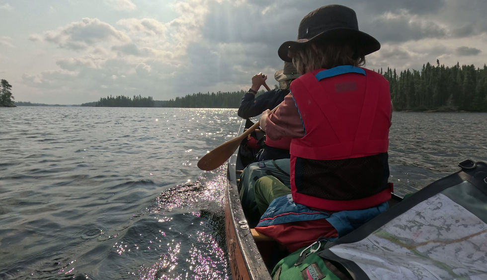
At the next closest island, we tuck into a little sheltered notch and watch the storm build. It begins to rain. Then it begins to rain heavily. We have no choice but to sit in the canoe and wait this out. The storm rages for nearly forty minutes - an exhilarating display of thunder and lightening, booming and crackling with a biblical fury. Ozzie, normally sphinx-like and stoic, sits in the bow with pleading eyes, sopping wet and trembling.
And then, just as quickly as it arrived, the rain ends, the wind calms, and the sun breaks through once again. We seize the moment, pulling hard on the paddles. Wary of getting caught in more weather, we elect to zigzag from the safety of one island to the next, avoiding a more direct course across open water. As the sun scrapes the horizon and running on nothing but fumes, we arrive at the southernmost island and the mouth of the Boiling Sand River. High-fives and cheers as we drag the boat ashore, collapsing in exhaustion on a slope of open rock.
There is a rough but very good campsite here. We clear away some deadfall, get a big fire going, and celebrate an achievement that I would not have thought was even remotely possible when we set out this morning. All told, we paddled more than thirty kilometers over eight hours, through some incredible scenery and just about every kind of crazy weather. We've also put ourselves in a great position to complete the trip with the time we have left. An excellent day!

August 13 - Day 11
Boiling Sand River to Tamarack Lake
Mixed Sun & Cloud, 18°
A cold morning under dark, heavy skies – more late October than August. We emerge from our tent in wool sweaters and toques, rubbing hands together, in need of hot coffee. After yesterday’s punishing marathon of a paddle, we have a lighter day planned - heading upstream on the Boiling Sand River to Tamarack lake, about fifteen kilometers away.
While researching this trip, poring over maps on dark winter evenings, one feature stood out as particularly intriguing: the Boiling Sand River. Such an evocative name, conjuring images of turbulent rapids, clear sparkling water, and many intimate beaches waiting to be discovered.
We’re mildly disappointed to find that “Boiling Sand” is aspirational at best and not indicative of the river's actual character - not as it appeared in my imagination at least. It does have a shallow bottom of soft, beautiful sand and it is certainly very pretty. But beyond that, it is gentle and placid – a slow, winding meander through lily pads and marsh reeds.

We arrive at Boiling Sand Rapids, where the river compresses through a lovely but impassable boulder canyon. A well marked portage rises high along the steep forested edge, with occasional views down over gurgling, aerated water – as close to a boil as the Boiling Sand gets. Just beyond, we pause for lunch at a spectacular campsite on the top of an enormous house-sized rock overlooking the river.
We carry on into the afternoon, gently meandering back and forth, and a half hour later we spot another canoe in the distance up ahead, occupied by a young couple with a dog. They are paddling an orange canoe, so they are obviously very cool, and they are heading our way. We pause to chat in the middle of the river. They have come from Tamarack Lake and just spotted a caribou in a little bay down river while looking for a place to camp. Caribou are plentiful throughout Wabakimi, but elusive, and we have yet to see one. We alert them to the beautiful site we just left and after exchanging farewells, proceed silently along, eyes and ears scanning the shoreline, but the caribou, unfortunately, is nowhere to be seen.

By late afternoon the sun has come out, and the river opens into Tamarack Lake. I think Tamarack may be one of the most beautiful lakes in all of Wabakimi. It has some dramatic topography with many high granite hills rising steeply out of the water. It has a distinct Temagami vibe, but with a far more rugged shoreline and impressive cliffs all over the place.
In the heart of the lake we discover a truly wonderful campsite – easily one of the finest of the trip – perched atop a small, gumdrop-shaped island. The smooth rock rises up to a high, open lookout with sweeping views in every direction. A few steps down on a lower plateau is a perfectly level tent site, and the water is deep and clear.
We swim until the sun disappears below the horizon, then gather around a crackling fire as the sky deepens and slowly comes alive with a vast and shimmering canopy of stars. Levi is relaxed and content, curled up with Ozzie while we trade stories and play cards. At one point, he remarks that this is his happiest moment of the entire trip. These adventures can be hard on him, and his words stir a swell of heartwarming feelings as the night settles gently in around us. It may be my favourite moment of the trip, too.


It feels like we are very much alone out here, hundreds of miles from any kind of civilization, but in fact that is partly an illusion. Not far to the south of Tamarack Lake, the main CN rail line linking eastern and western Canada threads its way across the land. We crossed those same tracks last year, further west at Shawanabis Lake, and we will cross them again on this trip too.
In the quiet of our tent, all of us laying still and silent, we are lulled to sleep by the occasional faint rumble of distant trains rolling through. Mostly freight, but also passenger trains from Vancouver and Toronto, with luxurious berths and fine dining, speeding through the wilderness just a few miles away, their presence both surreal and just a little wonderous.

August 14 - Day 12
Rest Day, Tamarack Lake
Sunny, 23°
Tamarack Lake marks the end of the second leg of our journey. The third and final stage will carry us over a series of portages into Rushbay Lake, then down the seldom-paddled Collins River to Bukemiga Lake, and our take-out on the Kopka River.
From the moment we first considered this route, the next stretch, from Tamarack to Rushbay, has been the only piece that makes me uneasy. Five portages lie ahead, rarely used and reportedly overgrown. The first, and most concerning, is roughly 900 meters long. Bushwhacking that distance through dense forest with packs and a canoe could be a complete non-starter, depending on actual conditions. But even if we manage that first one, there is no telling what condition the other four might be in, and once we have committed, turning back would be difficult.
We decide to take a day off here, to enjoy this incredible spot, to rest, but also to carry out a reconnaissance mission and scout that first worrisome portage. First, we need to find it. Then we want to see if we can walk it without gear. I have brought a length of fluorescent orange field tape. If we can find it and walk it, we will also mark it with blazes for the big push through tomorrow.
If none of this works out, there is a ‘plan B’: Tamarack Lake is accessible by a rough bush road somewhere to the east. If the portage is impassable, or if it looks like it would just be a miserable hell, we can always send a satellite message to our friends at Mattice Lake Outfitters, and arrange a vehicle pick-up.

According to our maps, the portage loosely follows a creek flowing into the southernmost corner of the lake, about an hour's paddle away. It takes some searching, but hidden within dense alders we spot a trickle of a stream dribbling out from the forest. There is no landing to speak of. We haul our canoe through thick brush and begin to look around.
We pick up the faintest trace of a trail - very rough and overgrown, but a trail nonetheless. Most importantly, it seems passable. We lose our way a few times but quickly get our bearings again, tying orange blazes to branches here and there, so we can find our way back and mark the trail for tomorrow. With packs and a canoe, it will still be slow and difficult, but we can definitely do this. After half an hour of hiking, a glimmer of open water appears through the trees: Cannon Lake.
This is a huge relief, and we are in very high spirits paddling back to camp, where we enjoy the afternoon relaxing, swimming, and swinging in the hammock, all the while feeling much more confident and excited about the route ahead.
It’s a warm, clear evening, and we tie the tent fly open to enjoy a welcome breeze. I set an alarm for 2:30 a.m. to see if we might glimpse a shimmer of Aurora Borealis, but when I wake and peer outside, there is only heavy cloud. Around 4:30 a.m., I am jolted awake again, this time by strong winds ripping through the open tent, causing it to shudder. Ozzie sits on high alert at the foot of the tent while lightening flashes and rumbles in the distance. I scramble to close the fly and secure our gear, and a moment later the storm is upon us. Rain crashes down in buckets as rapid pulses of lightening strobe through the tent. Levi and Ozzie press in close, as our thin nylon shelter shakes violently against the wind. The storm rages with wild intensity for at least a half hour before it starts to weaken and we can all get back to sleep.
By morning, everything is calm. Outside, I find our canoe has been pushed down the rock slope, flipped upright, and is half-filled with rainwater. Without overstating things, this was, without question, one of the most intense lightning storms I’ve ever experienced. Weeks later, back home in Toronto, we learned that a tornado had touched down that very same night, near Pikangikum, not far to the west.


August 15 - Day 13
Tamarack Lake to Rushbay Lake
Sunny, 30°
We’re up before sunrise, ready for a long, demanding day. It’s going to be a hot one too - the sun already blazing as we break camp and retrace our route to the portage, where a fresh orange blaze tied to an alder branch marks the takeout.
We always double-carry our gear, which means every portage is walked three times. First, we slog the packs across, drop them at the opposite landing, trudge all the way back to retrieve the canoe, and do it all again one last time. It’s a slow, tiring ritual, but we just have too much gear to carry in a single trip.
A round of fist-bumps and off we go.
It is certainly a more difficult walk with our packs, which pull us off balance and are constantly snagging on the dense encroaching foliage. There is a grassy meadow at the halfway point, where we drop everything and head back for the canoe. The weight of the canoe creates some momentum that makes crashing through the bush actually a little easier, but only when moving in a straight line. Pivoting a sixteen foot canoe in dense trees is considerably less fun. After an hour and a half, we reach the shore of Cannon Lake and slump down exhausted for lunch in the boat. So far so good, but there is still a long way to go.


We quickly arrive at the next short portage: up and over the railway embankment, which cuts a straight line through the middle of Cannon Lake. From a distance this looks easy enough, but the tracks sit atop a two-storey ridge of loose crushed stone, sloped at a forty-five degree incline. There is simply no solid footing on this - each step loosens the rock beneath your feet, and you slide right back down again. After a strenuous, awkward scramble, we eventually lug everything onto a narrow ledge at the top.
Normally, Ozzie would be off exploring while we deal with the portage, but with the possibility that a train could rumble through at any given moment, we keep him leashed to the food barrel and start hauling our gear down the other side. He’s not happy about being left behind, taking a few hard lunges toward us before yanking the heavy barrel (with himself tethered to it) over the edge and tumbling Slinky-like down the steep slope. Somehow, both escape unscathed.

At the next short, 43-meter portage, we cross the height of land, passing from the Hudson’s Bay watershed into the Great Lakes watershed, just as we did around this time last year. The trail is reasonably good and we make quick work of it - three down and only two left to go!
We continue along a slow-moving creek which abruptly dead-ends at a most unusual sight: looking straight ahead, immediately beyond the water’s edge, there is nothing but treetops and sky - as if we were approaching the edge of a cliff. The stream has some current to it but doesn't continue forward. Where does it go? I jump out to investigate.
We have grounded on the edge of a massive natural dam, perhaps three or four storeys high. From the slightly raised lip where I stand, the purity of its form can be fully appreciated. It is parabolic, like the shape of a hydroelectric dam, but flipped concave and bulging outwards, designed by nature to contain the force of water rather than push against it. Composed entirely of organic material, porous and saturated, little rivulets of creek water spring from its steep back slope. With fully mature forest surrounding on all sides, it looks as though it has been here forever, holding the riverscape in a perfect, precarious balance. Perhaps there is a stunning waterfall somewhere deep below our feet, buried under decades of accumulated mud and branches. Who can say? In all our travels, we’ve never seen anything like it.
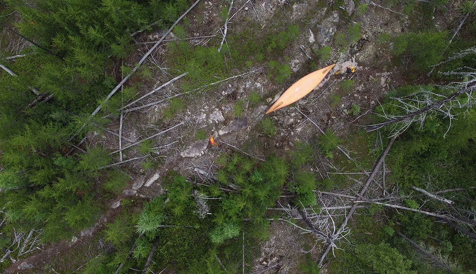
This is the second last portage of the day - a relatively short 110 meters. It’s odd that the earlier portages had at least some faint evidence of a trail, but here there is nothing whatsoever. Leaving our gear behind, we bushwhack down the spongey, mucky back slope, bulldozing our way through dense alder thickets, hoping to find some reasonable path through this mess. There is none. We return for the packs, resigned to blazing our own trail, tying bits of flag tape as we go so we can find our way back to the canoe.


As punishing as these portages can be for us, try to imagine what Ozzie must be enduring. Imagine being eighteen inches tall and armless; crashing face-first through tangled branches and wet foliage; sinking into mud so deep your belly drags through it. Imagine doing this again and again, all day long, with no sense of where you are going, or why. Even if he could complain I’m not sure that he would, accepting his fate with quiet resolve through pretty much everything that comes his way. I tell you, Ozzie is the unsung hero of our small, intrepid crew.
At the base of the dam, the terrain opens into a grassy marsh, crisscrossed by a dozen narrow streams. It’s thirty degrees, we’ve been baking in the sun all day, and are running out of steam. We stagger through the shallow water, finding this to be the path of least resistance, occasionally pausing to pour hats full of cool, clear water over our heads. At last the lake comes into view. This short carry alone has taken an hour and a half to get through. A final indignity comes right at the end, as I step into a fresh pile of bear shit, studded with undigested blueberries.
The last portage is mercifully easy, and we arrive at Rushbay lake, our destination for the day. There is a marked island campsite at the very south end - small but cozy, with a flat sheltered area tucked into the trees. It’s late - nearly 8 pm. After a quick swim, we slump silently over bowls of chili and immediately collapse into the tent, utterly exhausted.
To anyone contemplating this route, I offer this: if we can do it, you can too, but it was an absolutely brutal day - the hardest of the trip by far. To my amazement, Levi is doing fine - doing great, even! My goodness, what a trooper.

August 16 - Day 14
Rushbay Lake to Collins River
Sunny, 22°
Today we’ll be heading down the Collins River - the final stretch of the trip and potentially one of the most interesting. The Collins flows over the same dramatic ridge that forms the ‘Seven Sisters’ section of the Kopka River further west – a spectacular chain of drop-and-pool waterfalls we passed through last year. The Collins is the quieter sibling to the Kopka: seldom paddled and largely overlooked, but equally full of wonders.
We are aiming for a marked campsite about halfway downstream, where the river flows through a narrow canyon lined on both sides with impressive cliffs. We hope to arrive early and spend the afternoon there, and we are up with the sunrise, eager to get moving.


Most of Rushbay Lake is barely a foot deep, and we drag the canoe across broad gravel shoals as we slowly work our way south. At last, and with great anticipation, we slip into the Collins, only to be immediately confronted by a gauntlet of huge beaver dams. Most can be bulldozed over but the last of these is a beast, easily six feet high, leaving us with no choice but to empty the boat and lift our gear piece by piece over the loose jumble of sticks and logs.
From there, we run, line, and wade through a winding and very pretty stretch of shallow swifts, the forest pressing in close on either side, until an impenetrable wall of deadfall clogging the river brings us firmly to a halt. We must have missed a portage, but a short bushwack through the woods brings us to a reasonably good trail.

The rocky walls containing the river become higher, steeper, and more dramatic. We pass through a deep canyon of talus like the aftermath of some enormous ancient rockslide. Great slopes of broken rock rise ten stories high on either side, converging toward the river in a perfectly symmetrical ‘V’.
Just past noon, we reach the final portage of the day, descending steeply alongside a chain of noisy waterfalls before emerging into what feels like a forgotten, hidden world. We drift awestruck into an intimate bay, enclosed on three sides by towering, sheer cliffs rising in great pillars from deep, black water. Off to one side, a small raised plateau, just wide enough to camp on, nestles up against the rock face: our humble and majestic home for the night.

We swim in the cool, deep water, then get ourselves settled in. For such a small campsite, you really couldn’t ask for anything more.
Not to brag (or come across as weirdly eccentric), but Maggie and I have spent A LOT of time camping; on multi-year cycling trips and many dozens of long canoe trips. If we were to add-up every night we’ve tented in the wilderness, the total would come to more than four years. Many of those nights were spent in some of the world's most beautiful landscapes. So, we have a rather discriminating (bordering on snobbish) set of criteria for what constitutes a truly great campsite.
First, the obvious practicalities: A great campsite should have a spacious and level tent pad, ideally tucked back in trees. It should have a comfortable open gathering area, with well-placed fire ring and the ability to string a tarp overhead should there be any weather. It should have good access to sun, but also to shade. It should have easy access to clear and clean water; good swimming; a good landing area for the canoe; a place to string a hammock… Putting all of that together may not seem like such a big ask, but most campsites fall short in at least one or more categories.
Then there are the intangibles – the atmospheric attributes that can elevate a campsite from simply 'great' to something truly special: a majestic waterfall thundering past; a cliff-side perch with perfect sunset view; a non-stop parade of forest wildlife; an intimate sanctuary contained within majestic cliff faces... This place checks every box and is without question uniquely special.
We are often baffled by the way campsites have been laid out, and will sometimes rearrange a few things to make them more pleasing. We can’t help ourselves – we’re both Architects!


It’s our last evening in Wabakimi - cool, clear, and utterly still. We gather around the fire, reflecting on the fullness of the trip, as the cliff faces flare a brilliant gold, then fade to indigo in the falling light.
In the silence of the canyon, sound echoes as it might within an empty stone cathedral. At some point Ozzie gently barks at something, which ricochets off the surrounding walls, returning back to us from multiple directions. This sets off a hilarious chain reaction of call-and-response, as Ozzie grows increasingly alarmed by all the barking dogs that have suddenly arrived somewhere just out of sight. We love Ozzie to bits, but he is definitely not guard dog material.


August 17 - Day 15
Collins River to Bukemiga Lake
Sunny, 23°
A gorgeous morning greets us on this, the fifteenth and final day of our Wabakimi adventure.
Today we continue down the length of the Collins River, across Bukemiga Lake, then a few kilometers down the the Kopka River to the same takeout point as last year, where our car (hopefully) awaits. There are five portages to negotiate on the Collins, and Bukemiga is a vast and potentially windbound expanse of open water. We aren’t taking anything for granted, but we are well positioned to reach the finish line today. Levi, for his part, makes it clear that he will be driving to Thunder Bay tonight, either with us or without us.

We linger over coffee, drinking in the spectacular views as sunlight rakes the canyon walls, burning away a thin morning mist. You can never really know if you may be seeing a place for the very last time. In this case, it’s likely that we are, and we take our time with breaking camp and loading the canoe, pausing every so often to look around and take it all in before setting off.

The towering cliffs and deep canyon scenery continue on for quite some time before we reach the first four portages which are grouped closely together, one right after the other. The first (50 meters) is straightforward, but the second (128 meters) is a treacherous scramble down a steep slope of jagged and broken slabs of rock. The footing is terrible, with ankle-twisting gaps between slick, moss-covered boulders. Even Ozzie can’t manage on his own and needs to be carried through sections.
My notes indicate that the third portage (136 meters) is equally challenging but turns out to be easy, bringing a welcome boost of morale and energy. The fourth (49 meters) is a clear, level trail which we practically jog through. At this point we are strictly business – barely glancing at the many small waterfalls cascading through this very pretty stretch, buoyed by visions of Thunder Bay's abundant deep-fried offerings and the relative opulence of a motel room with television.


At the final portage (160 meters), the majestic Collins River spills from the woods into Bukemiga Lake as little more than an unassuming trickle. Somehow, after so much dramatic beauty, it seems to just run out of magic right at the end. Or, just maybe, it prefers to be left unnoticed. Approaching from the opposite direction, you might struggle to even find it, tucked under a camouflage of low hanging branches. You would certainly never suspect the magnificent world hidden away upstream. Even more mysterious is that the Collins lies just outside the Wabakimi park boundary - unprotected, unmaintained, and largely ignored. This is difficult to understand. It’s a special place, and would be an excellent addition to the park for so many obvious reasons.


Bukemiga Lake opens up before us – the very last stretch of our trip.
Paddling those last few kilometers is both relaxing and exhilarating. We pass the time playing ‘ABC Food’ – a game Levi invented on a previous trip. This involves moving through each letter of the alphabet and calling out every sumptuous food craving you would love to get your hands on: Burritos, Bacon, Bananas, Brownies, Bread & Butter (double points), and so on. Some of these offerings elicit slow, approving nods and quiet, drawn-out “Mmmmmmmm”s. Others trigger a resounding, emphatic “YES!”, punctuated with loudly exaggerated lip smacking.
This would be cruel self-inflicted torture were Thunder Bay not just a few hours away.

The Kopka bends gently south, and the landing where our car awaits slowly comes into view. We retrace the final kilometers of last year’s route, which looks exactly the same yet somehow feels completely different.
No good journey ever repeats itself. We’ve paddled the same routes through Temagami a dozen times, but they’re never really the same, each experience shaped by a unique blend of weather, unexpected hardships, small triumphs, and fleeting moments of rapture. Our two adventures in Wabakimi have been no different. Though separated by only a year, they feel like worlds apart.
Yet beneath that ever-changing ebb and flow lies a constant current of gratitude, felt most deeply right at journey's end: gratitude for wild places, and the memories made exploring them together.
See you next time, Wabakimi!
